The intersection points of the two layers can be found in the GISLayer software. This document explains how to find an intersection.
The intersections of the two layers on the map can be found by selecting from the map or by selecting from existing layers. In order to access the geometry intersection panel, the 'Intersection' button in the 'Tools' menu is clicked.
![[Finding Intersections Between Geometries]](/img/docs/editor/min300/77-1-en.webp)
1. Finding Intersection of Geometrics Panel
![[Finding Intersections Between Geometries]](/img/docs/editor/min300/77-2-en.webp)
There may be intersections between layers in two different ways, "By Choosing Geometry from the Map" and "By Choosing From Existing Layers".
1.1. By Selecting Geometry from the Map
The option to select geometry from the map is selected as the geometry usage method.
Information to be entered at this stage:
1.Selecting the first geometry from the map
- Selecting the second geometry from the map
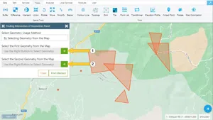
After the required fields are filled, the "Find Intersection" button is clicked.
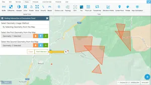
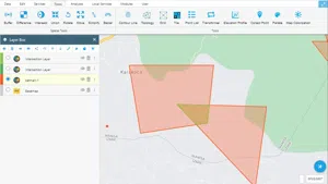
An example result is shown below.
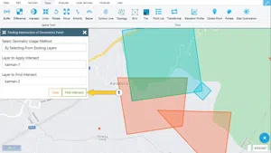
1.2. By Choosing From Existing Layers
The option to select from existing layers is selected as a method of using geometry.
Information to be entered at this stage:
1.Intersection layer to be applied
2.2.Intersection to the Layer
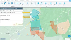
After the required fields are filled, the "Find Intersection" button is clicked.
An example result is shown below.


Related Documents