Step 1: Add New Layer
The results of the Overpass API query are added to an active layer on the map. Therefore, a new layer must be created.
Note: You can easily create the layer with the quick layer creation button.
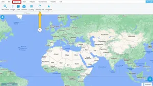
Step 2: Services 🡪 Overpass API
The Overpass API is a read-only API that provides specially selected sections of OSM map data.
The data selected via the "Overpass API" menu in GISLayer can be visualized on the map.
Click the Overpass API button on the Services tab.
NOTE: The Overpass API query is performed within the boundaries of the map displayed on the screen. Zoom in on the map where you want to get information. To get results, the map scale should be 1:500 in meters or more.
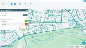
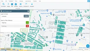
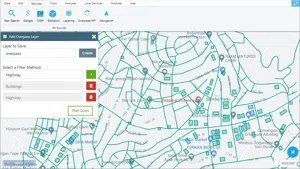
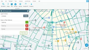
Step 3: Overpass Query Panel
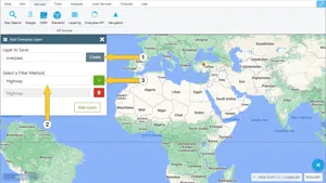
There are 3 options in the Overpass query panel.
-
The layer on which the query is to be saved must be selected.
-
The query to be applied must be selected.
-
By clicking the + button, the query is added. More than one query can be added. (It is explained in Section 3.2.)
The Overpass queries that can be performed on GisLayer are listed below.
-
Filtering Path
- Roads
- Highways
- Bus stops
-
Filtering Building
- Buildings
- Cafe
- Restaurants
- Theaters
- Bank
- Market
- Fast Food
-
Filtering Places for Leisure Time
- Outdoor Locations
- Parks, Gardens
-
Filtering Sports Centers*
- Gyms
- Swimming Pool
1. Apply a single filter
This explains that only one request is sent to the Overpass API.
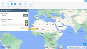
After selecting the layer and query where the query result will be saved, click on the "Run Query" button.
The button to the right of the selected filter method allows you to delete the filter method.
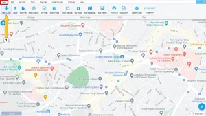
The sample query results are shown below.
2. Apply Double Filter
This explains that two requests are sent to the Overpass API.
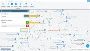
Select the layer where the query result will be saved. After selecting the filter method, click the + button and select a filter method again and click the + button. After selecting the desired filters, the "Run Query" button is clicked.
The button to the right of the selected filter method allows you to delete the filter method.
The sample query results are shown below.


Related Documents