View of layers with map loaded in GISLayer software can be changed. Styling can be made based on geometry type. For the styling panel, click on the "Style Layer View" button after the layer is activated in the layer box.
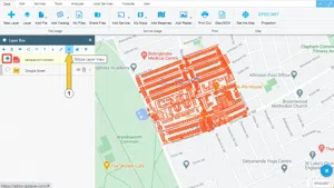
1. Layer View Styling Panel
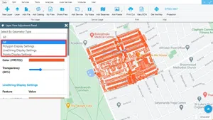
Polygon, line and point geometry styling is described in this section. It can be selected according to the geometry type or the styling of all geometry types can be changed.
1.1. Polygon Styling
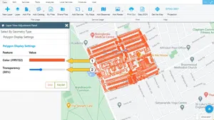
In polygon geometries:
-
Colour,
-
Transparency styling can be made.
1.2. Line Styling
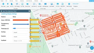
In line geometries:
-
Colour
-
Transparency
-
Density
-
lineCap
-
lineJoin
-
lineDash styling can be made.
1.3. Point Styling
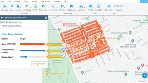
In point geometries:
-
Colour
-
Transparency
-
Radius styling can be made.
An example styling work is shown below.


Related Documents