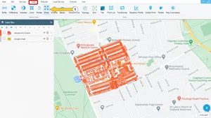
You can use this method if the geometries on the map are not where they should be.
Step 1: Tools -> Move
Select the Tools menu and then click the Move button.
Step 2: Geometry Move Panel
The panel has two different types of use. The user can move a single geometry or an entire layer from the map, depending on his needs.
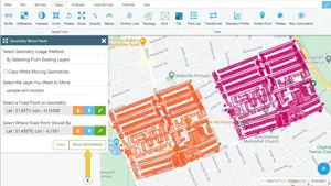
2.1. Move Selected Geometry on the Map
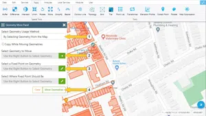
- The used method should be Select Geometry on the Map.
- You can copy the geometries by activating the Copy Geometries While Moving button.
- To select the geometry to be moved, Click the button on the right and select geometry on the map.
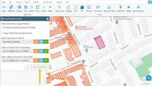
- To specify the point to be moved click the button on the right and select a point on the geometry.
- To move the geometry to where it should click on the button on the right and then select a point on the map or enter if the coordinates of the new location are known. After this step, a preview of the geometry to be moved will be displayed on the screen. To finish the action click the Move Geometries button.
2.2. Moving All Geometries in a Layer
If you want to move all geometry in a layer, you can move it faster by selecting this existing layer.
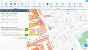
- The used method should be Select Existing Layer.
- You can copy the geometries by activating the Copy Geometries While Moving button.
- You can choose the layer you want to move from the list.
- To specify the point to be moved click the button on the right and select a point on the geometry.
- To move the geometry to where it should click on the button on the right and then select a point on the map or enter if the coordinates of the new location are known. After this step, a preview of the geometry to be moved will be displayed on the screen. To finish the action click the Move Geometries button.


Related Documents