- Project: WEB GIS Project
- Category : Data Editing
- Status : Online
- Owner : GISLayer
Are You Ready to Do Your Project With Us?
Contact UsHow the WEB GIS Project Started
The codes we wrote for our customers were similar from time to time and they could be managed from a single platform. When we put together the blocks of code we produced over time, we were getting great results, and we that thought people could use them on a single platform. Thus, the foundations of the GISLayer company began to be laid. Over time, the parts were combined to create the Web-based GIS software and we presented the results of all these parts to our users to be used in servers.
Which Technologies Are Used
When we started to code WEB-based GIS software, we preferred to use up-to-date, popular and future-proof technologies and items we have mastered. If we meet a better technology in the future, we will not fail to use it.
Front-End Structure
- HTML5 + CSS3 + Javascript
- In Component Structure with Vue Js
- Styled with Metro UI
- Openlayers 5
Back-End Structure
- NodeJS
- Socke IO
- Sequelize
- Python
Database Structure
- Postgre SQL Postgis
- LocalStorage
- SQL Lite
Innovative Aspects
- Data Sharing Management
- Common User Authorization
- Real Time Usage
- Creating Map and Publishing
- Creating Layer Catalogs
Advantages
- Allows Teamwork
- Your Geometric Data Can Be Shared Instantly
- Displays Field Data Live
- Offers Free Services by Country
- No Single Device Requirement
- Using Vector Data as WMS, PBF
Future Planning
- Working Faster with Big Data
- Adding 3D View Support
- Adding BIM Support
- Remote Sensing Analysis
- Using Raster Data as Vector Data
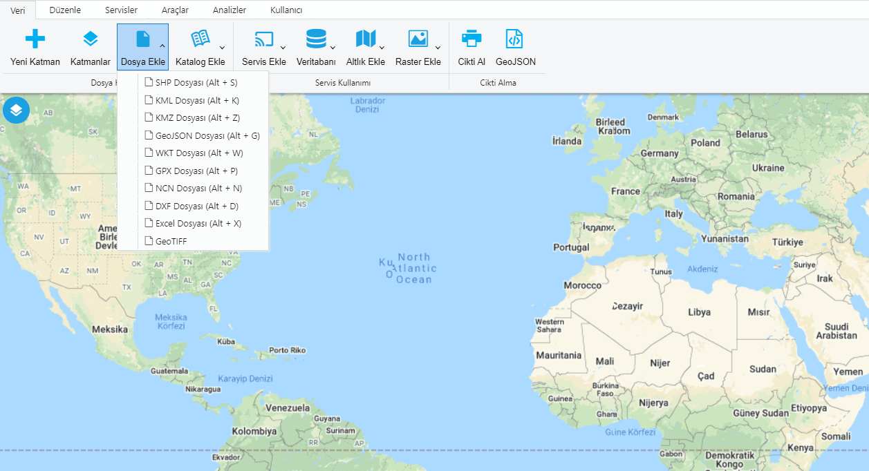
Available Data and Services
Many data and services that you can add or remove to the system are listed below.
- You Can Open Esri Shape File
- You Can Open Google KML and KMZ Files
- You can Open GeoJSON, WKT, GPX File
- You can Open DXF, Excel and NCN Point File
- WFS, WMS, WFS-T, WMTS, XYZ, MVT and PPF Publications
- Google, Yandex, Bing, Esri be Here Basemaps
- Raster, GeoTIFF and Image Basemaps
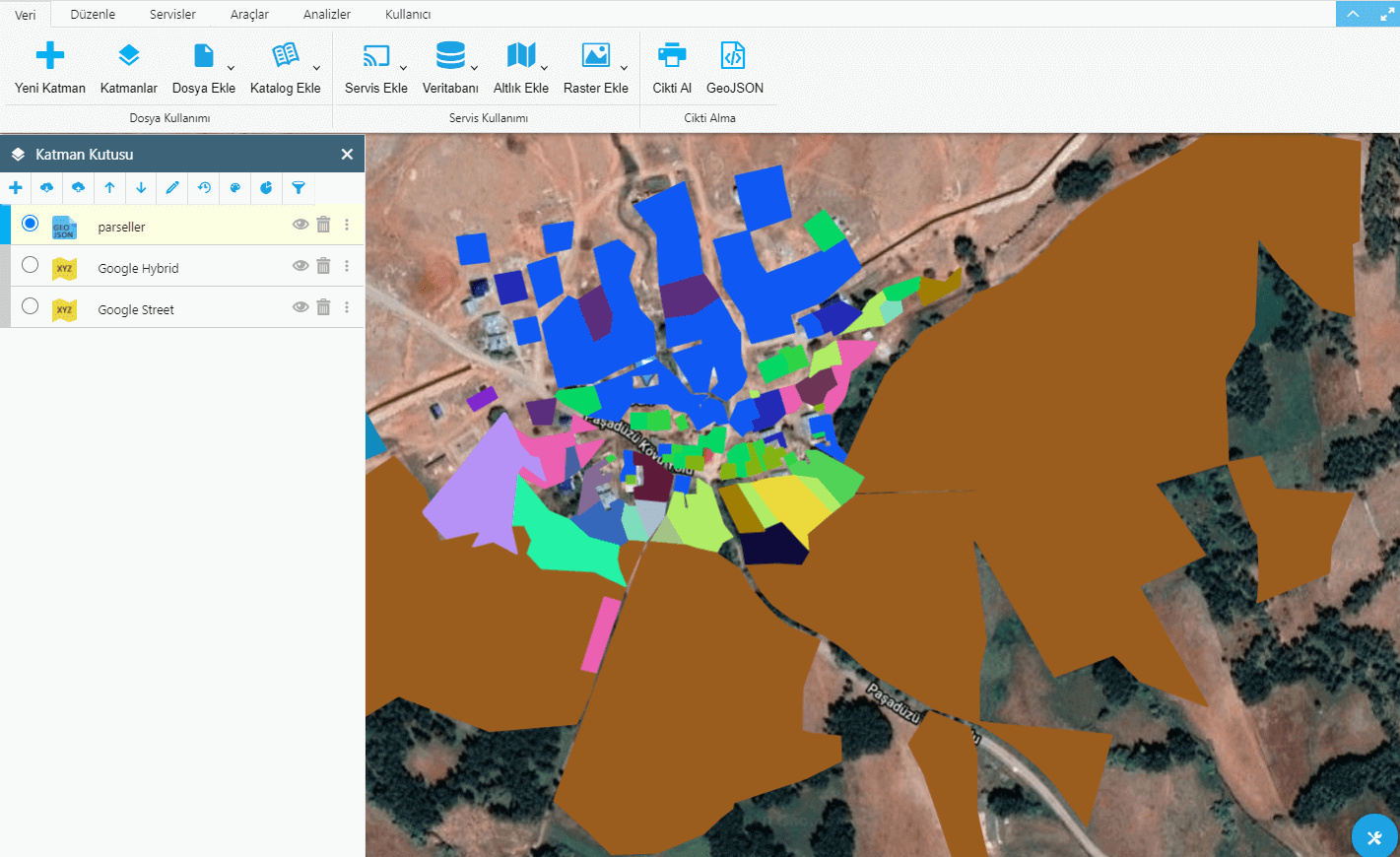
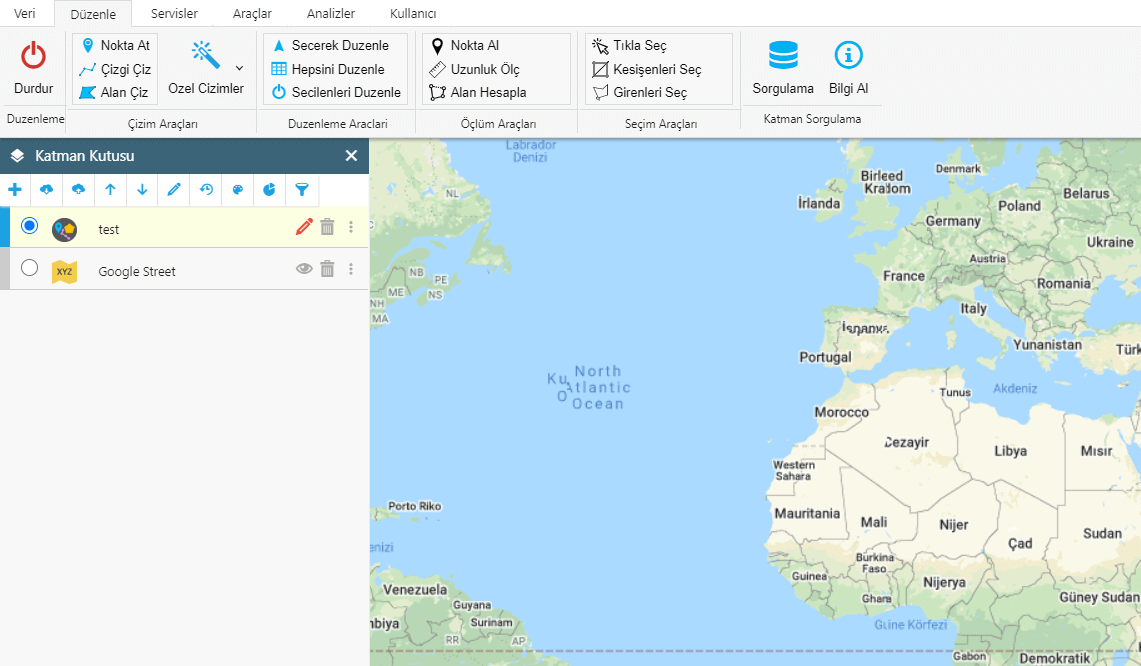
Editing and Drawings
You can edit and select your vector data and make new drawings.
- Point, Line and Polygon Drawings
- Circle, Ellipse, Arc, Square, Rectangle and Special Polygon Drawings
- Special Vector Selections
- Drawing by Entering Information by Hand
- Length and Area Measurements
- Verbal and Spatial Choices
- Getting Information on the Map
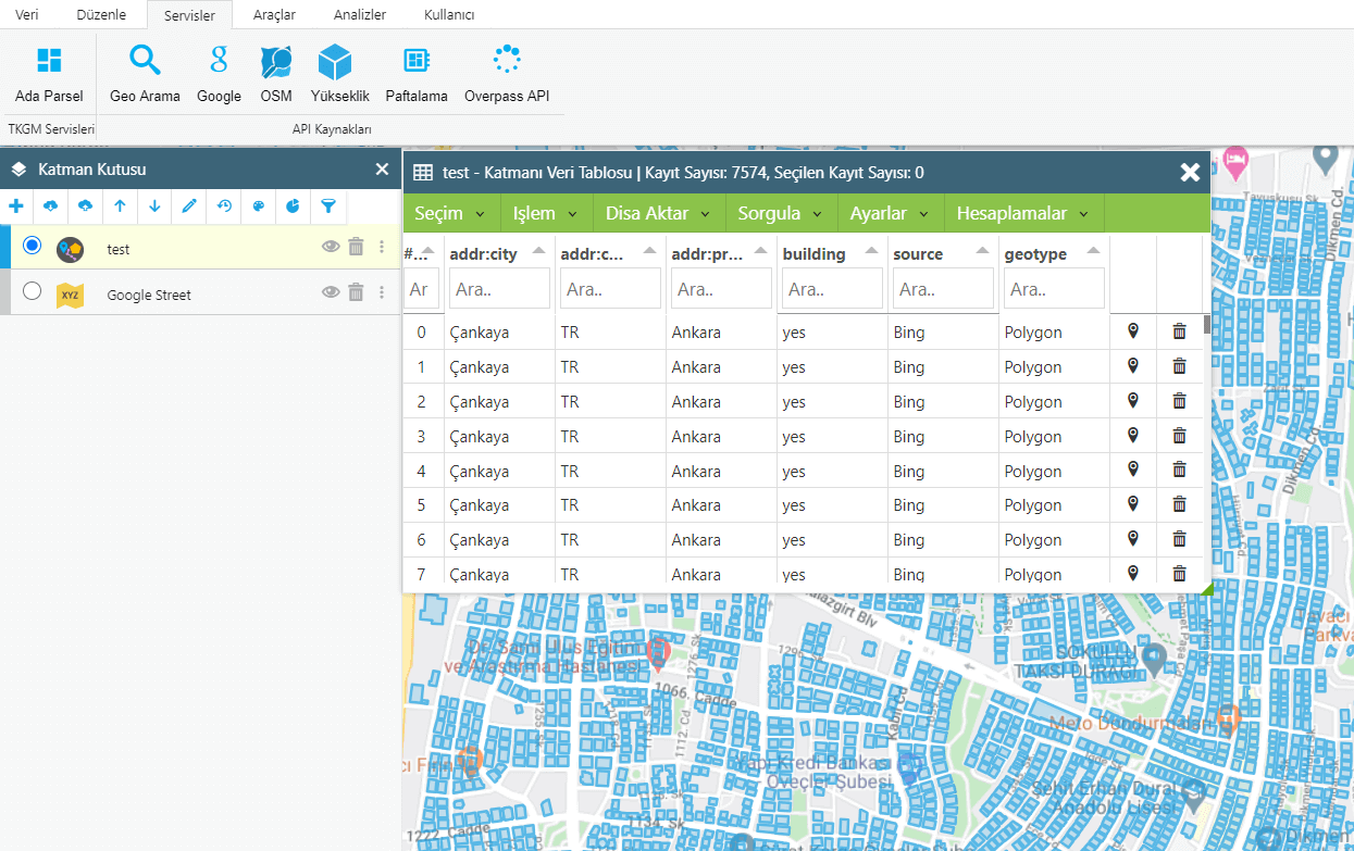
Services and Data Table
You can take actions on the data table of layers with advanced features.
- Spatial and Verbal Inquiry and Choices
- Filtering, Color Change and Previews
- Graphics, Verbal and Spatial Exporting
- Column Editing, Making Verbal and Spatial Operations
- Search for POI with Google
- Download Elevation Data
- Getting Vectorial data by the Overpass API and OSM
- Layering and Searching Geometries of Special Places
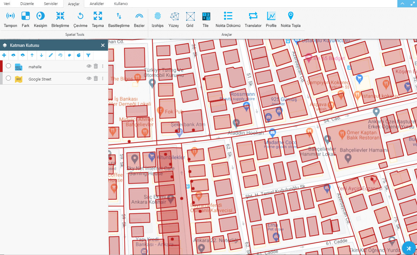
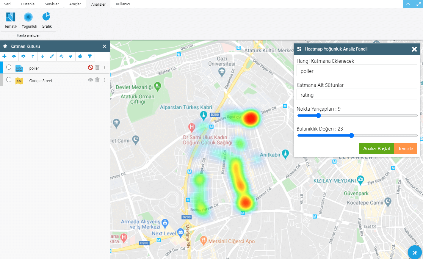
Tools and Analytics
You Can Use Many Spatial Tools and Generate Analyzes. You can:
- Find differences, intersections between geometries
- Merge geometries and create a buffer zone
- Rotate on a movable axis, Geometries are simplified,
- Create Bezier, Izohips, Surface Triangulation with Geometries
- Download Raster Tile maps for offline use.
- Draw a surface profile, collect three-dimensional points
- Apply coordinate transformations to points
- Create thematic and heatmap density maps
- Create pie, bar, area charts with geometries
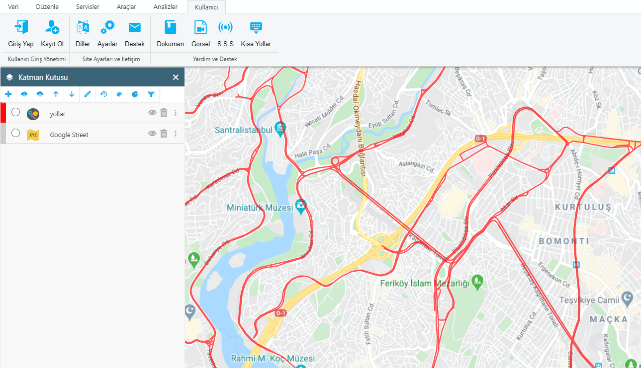
User Management
You can connect sub-users to your own management and share your data. You can:
- Create your own management network by combining with users
- Share data between users according to authorization
- Share your data privately or publicly
- Buy the packages we offer you whenever you want
- Create custom packages and use only certain features
- Host your data on GISLayer servers