- Project: BlueGIS Mobile GIS Project
- Category : Data Collecting
- Status : Online
- Owner : GISLayer
Are You Ready to Do Your Project With Us?
Contact UsHow did the BlueGIS Mobile Project Begin?
With our Web Based GIS software standing on its feet, it had to be used for field personnel, and a software that could work to meet the land needs made it felt necessary day by day so we produced a mobile GIS software. Thanks to WebSocket technology, this software was extremely useful in terms of data collection and was introduced as a stand-alone product. Using both web and mobile applications, users have become able to achieve more efficient results in their work.
Which Technologies Are Used
When we started coding mobile GIS software, we preferred to use up-to-date, popular and future-proof technologies and items we have mastered. We have been in favor of using the map library as Mapbox, unlike the Web. Of course, if we meet a better technology in the future, we will not fail to use it.
Front-End Structure
- HTML5 + CSS3 + Javascript
- In Component Structure with Vue Js
- Styled with Metro UI
- Mapbox GL JS
Back-End Structure
- NodeJS
- Socke IO
- Sequelize
- Python
Database Structure
- Postgre SQL Postgis
- LocalStorage
- SQL Lite
Innovative Aspects
- Data Sharing Management
- Common User Authorization
- Real Time Usage
- Creating Map and Publishing
- Creating Layer Catalogs
- Data Collection from the Land
Advantages
- Allows Teamwork
- Your Geometric Data Can Be Shared Instantly
- Displays Field Data Live
- Offers Free Services by Country
- No Single Device Requirement
- Using Vector Data as WMS, PBF
Future Planning
- Working Faster with Big Data
- Adding BIM Support
- Remote Sensing Analysis
- Using Raster Data as Vector Data
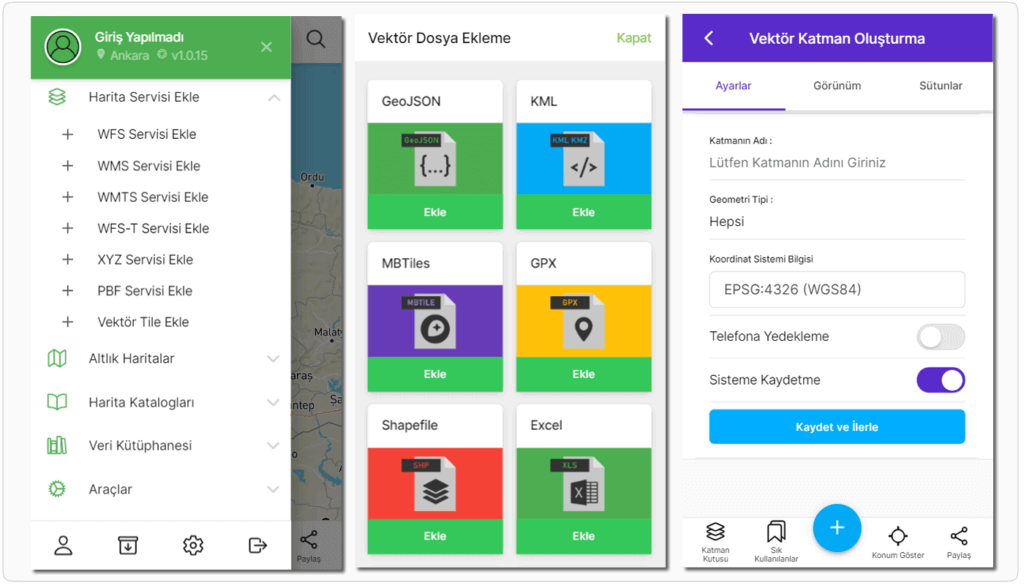
Vector Data Usage
Many data and services that you can add or remove to the system are listed below.
- You Can Open Esri Shape File (file.zip)
- You can Open KML, GeoJSON, WKT, GPX, Mbtile Files
- You can Open Excel and NCN Point File
- WFS, WMS, WFS-T, WMTS, XYZ and PPF Publications
- Open Street Map Styles
- GeoTIFF and Satellite Maps
Editing and Drawings
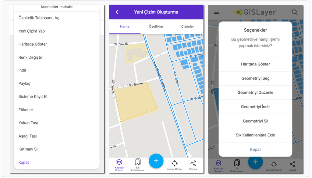
You can edit and select your vector data and make new drawings.
- Point, Line and Polygon Drawings
- Special Vector Selections
- Drawing by Entering Information by Hand
- Length and Area Measurements
- Verbal and Spatial Choices
- Getting Information on the Map
- Use of Layerbox
- Deleting Geometric Data
Tools and Calculations
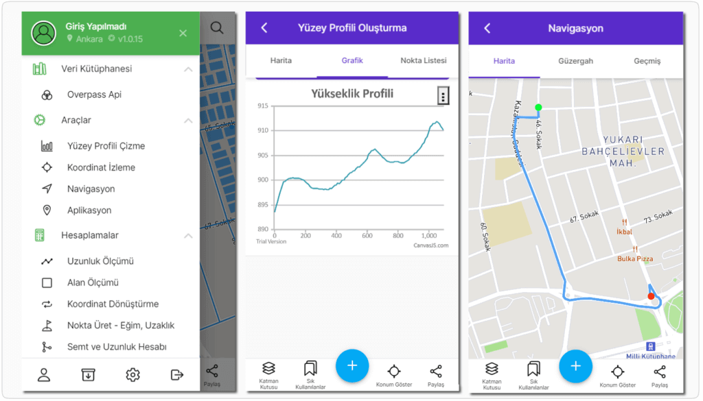
With useful tools and calculation methods, you can do your field work where you are.
- Creating and Exporting Map Catalogs
- Drawing Surface Profiles and Creating Charts
- Coordinate Collection and GPS Track
- Vehicle and Terrain Navigation and Application
- Point, Length, Height and Area Measurements
- Bearing Angle and Length Calculation
- Converting Coordinate
Data Table and Queries
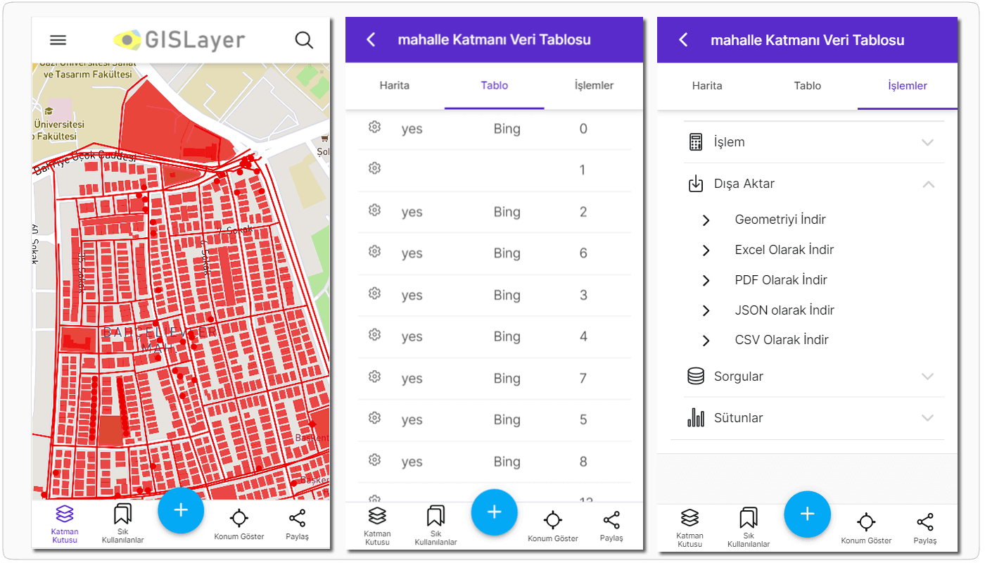
You can make geometric and verbal operations within your existing data and create special choices. You can:
- Share your data with other users
- Edit your data and add new information
- Easily find the data you choose or want.
- Easily export the selected data.
- Make verbal and spatial inquiries
- Add new data columns
- Make calculations using columns of data
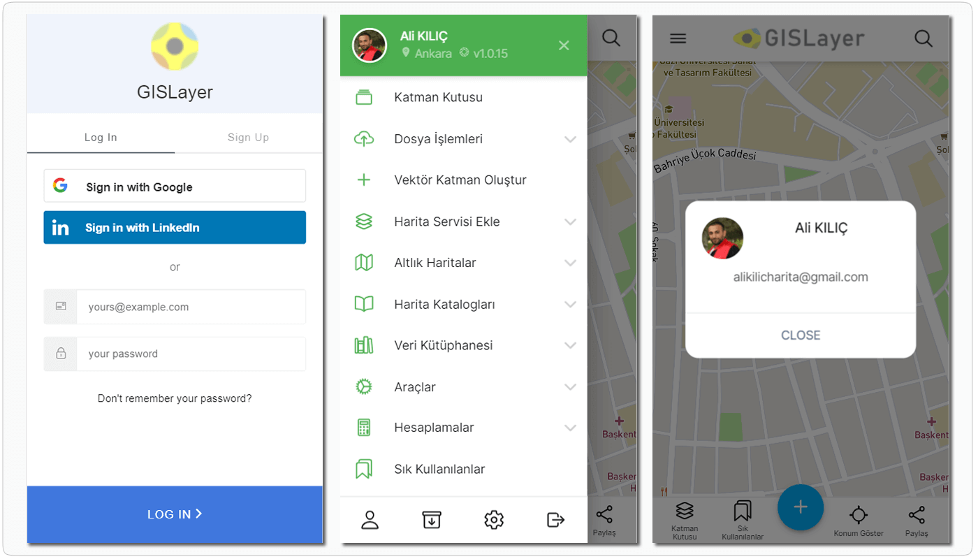
User Management
You can connect sub-users to your own management and share your data. You can:
- Create your own management network by combining with users.
- Share data between users according to authorization.
- Share your data privately or publicly.
- Buy the packages we offer you whenever you want.
- Create custom packages and use only certain features.
- Host your data on GISLayer servers.

