- Project: Map Publishing Software
- Category : Data Visualization
- Status : In Test Phase
- Owner : GISLayer
Are You Ready to Do Your Project With Us?
Contact UsHow did the Map Publishing Software Project Begin?
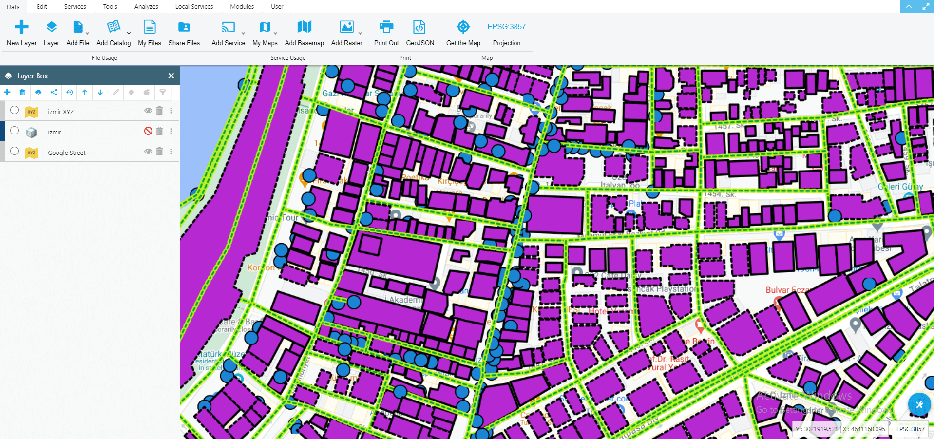
Since our two user-based applications, Web and Mobile, are stuck in certain obstacles due to the limitations of web technology in visualizing big data, we have developed a series of software to visualize big data on the map. Over time, we increased the software capabilities and made it a special software. It can be published not only within the scope of GISLayer but also on your own local servers. Users add their files to the software and define the view styles they want and can be published as PBF, XYZ, WFS and MVT. Using caching technology, it allows you to publish your maps on a single file or as files saved in folder directories. For this reason, it is presented to the user on our shelves as a highly capable software for free.
Which Technologies Are Used
We have come to a common ground in using electronJS so that the technologies we use while designing the map publishing software can be used in the same view in operating systems such as Windows, Linux and MacOS. Since the web codes developed here should also be able to run on a virtual server, a strategy was drawn in this way.
Front-End Structure
- HTML5 + CSS3 + Javascript
- In Component Structure with Vue Js
- Styled with Semantic UI
- Openlayers
Back-End Structure
- NodeJS
- ElectronJS
- Mbtiles
- SQlite
Database Structure
- Postgre SQL Postgis
- LocalStorage
- SQL Lite
Innovative Aspects
- Instant Style Definition
- Generating File Type Cache
- Open Source File Support
- Data Exchange with Common Platform
- Publishing to Vector Tile
- Publishing to XYZ Raster Tile
Advantages
- Usable on PC
- Can Publish on Server
- Easy and Simple Map to Publish
- Provides Backup and Move
- Fast and No Request Limitation
- Authorization and Restriction Available.
Future Planning
- WFS-T Service with Database
- Using Database Geometric Data
- Posting Remote Sensing Images
- Polygon Scanning and Using Multiple Layers
Uploading Vectoral Data
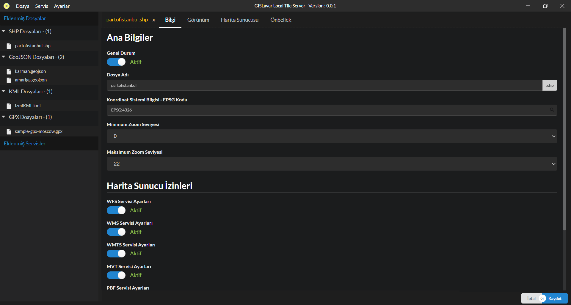
Many data and services that you can add and publish to the system are listed below.
- Esri Shape File ( shp, dbf ) Açabilirsiniz
- GeoJSON, WKT , GPX Files
- KML and KMZ Files
- TIFF Satellite Images
- PostgreSQL, Oracle and Mysql Connection
- Mbtiles and Geopackage File
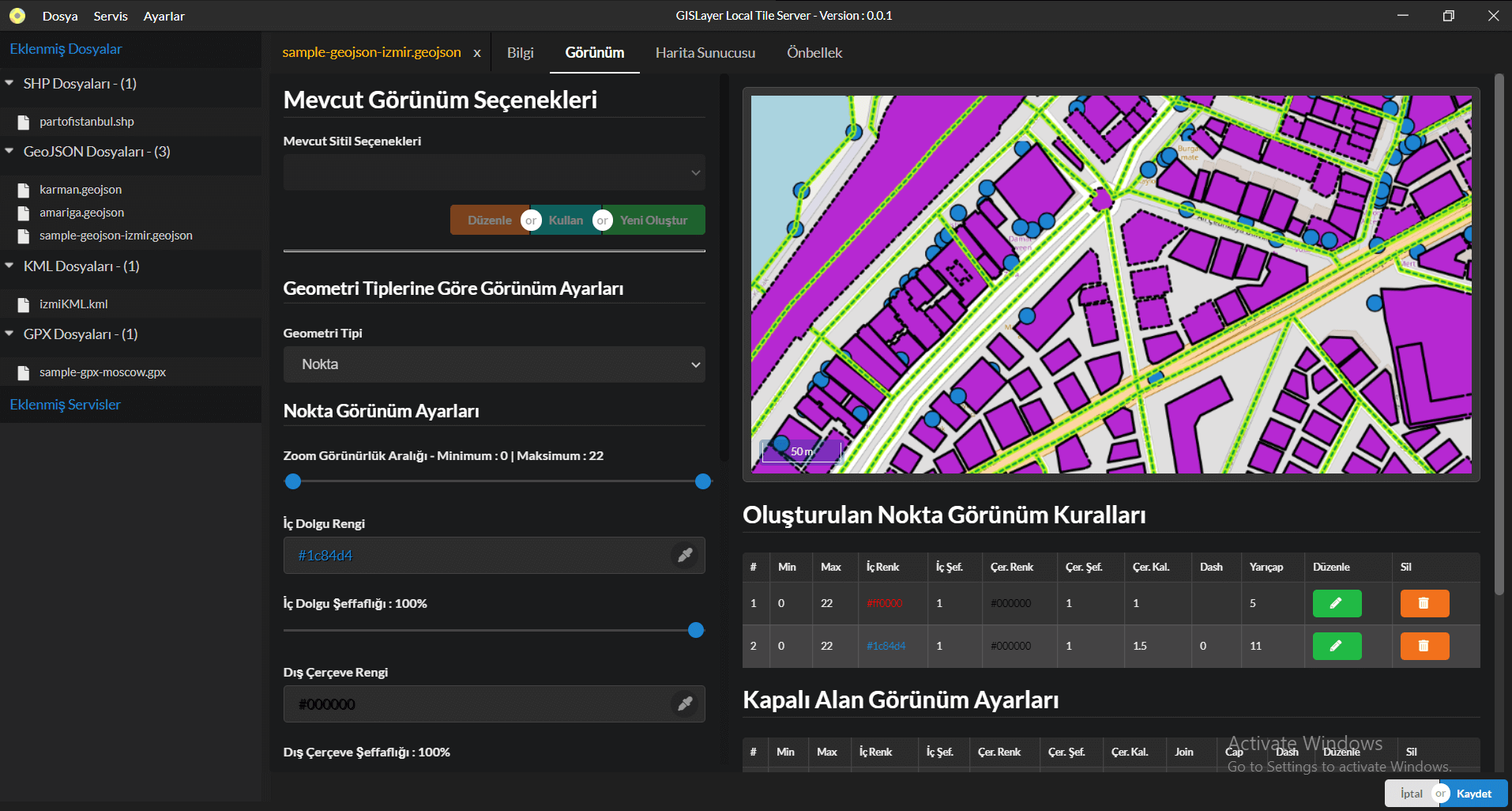
Appearance Settings and Styling
You can instantly see how your vector data will look before publishing it.
- Point, Line and Polygon Colorings
- Display by Zoom Level
- Filtering by Geometry Feature
- Seeing the Changes Instantly
- Using Common Styles
- Defining Custom Style to Layer
- Using Multiple Styles
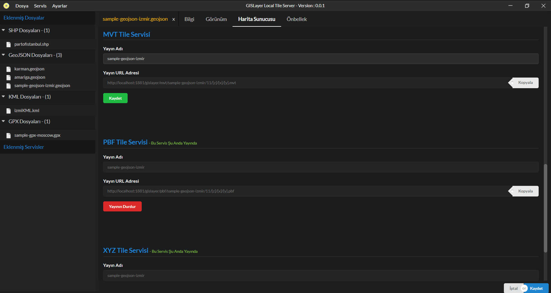
Map Publishing and Control
You can open and share your own data within the scope of the authorities you specify.
- Starting an OGC WFS Publishing
- Publishing to PBF Vector Tile
- Publishing to MVT Vector Tile
- Publishing to XYZ Raster Tile
- User Restriction with API Key
- Stop Publishing and Restarting
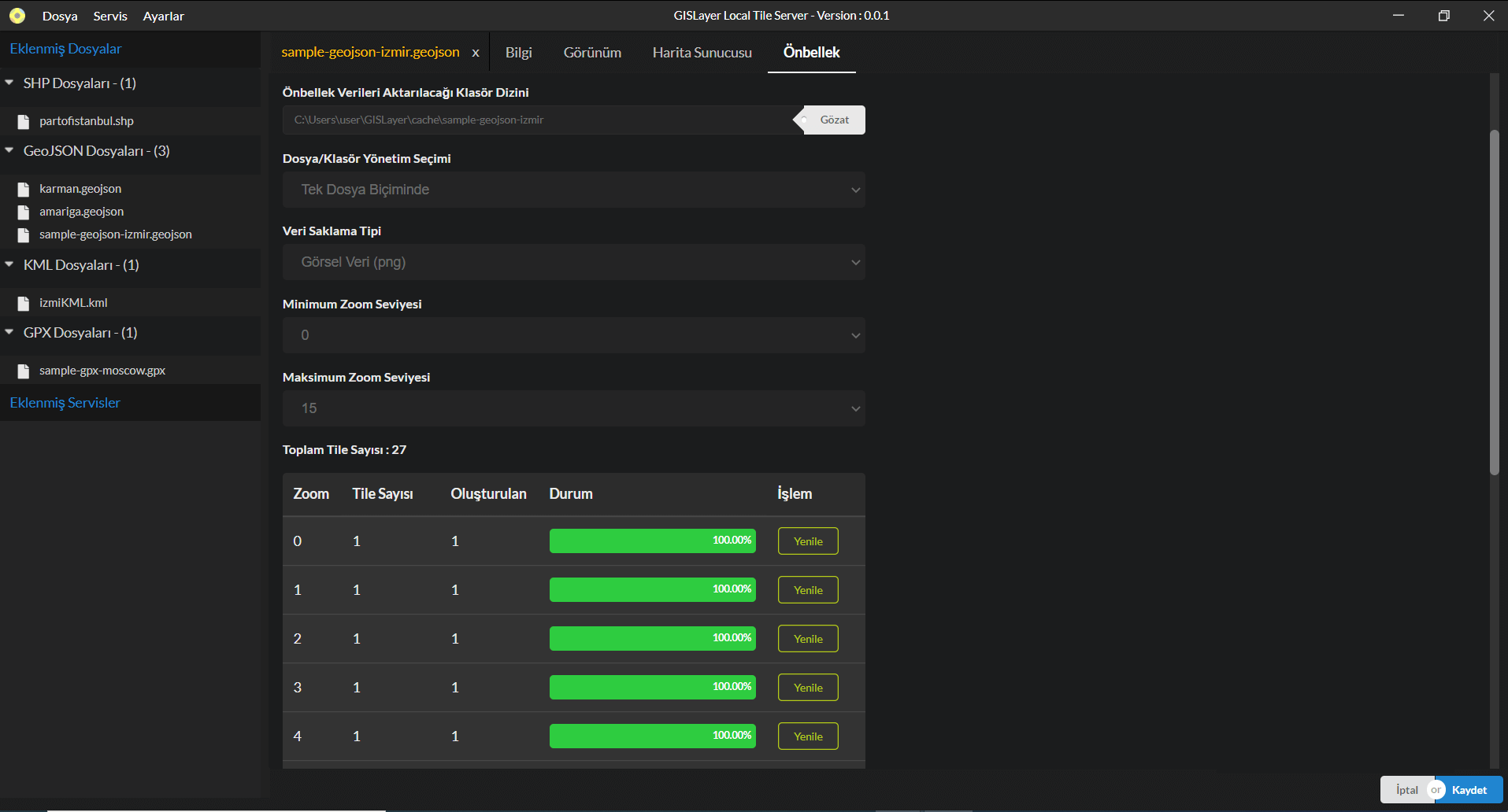
File and Folder Caching
It allows you to use your map feed under another source. You can:
- Produce PBF or PNG Tile in Mbtiles
- Generate {Z} / {x} / {y} PBF or PNG with Folder Hierarchy.
- Use your files independently in the computer or server.
- Create it between the zoom levels you specify.
Use in Other Softwareı
You can transfer or extract data to all software produced by GISLayer. You can:
- Add Your PBF, WFS, XYZ and MVT Publications to other software.
- Use Your Geometric Data Contained In GISLayer Software
- Reach your publications via GISLayer. You can show the publication.
- present the software on the Intranet and the Internet from Port Number 1881.